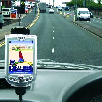
GPS systems can alert drivers of what routes to avoid
 London, November 19 : The World Congress on Intelligent Transport Systems (ITS) in New York will see this week a presentation on how GPS systems can help track traffic snarls.
One of the two systems, which went into operation earlier this month with a service known as HD Traffic, will be showcased at the event.
Media reports suggest that this system can be helpful in improving traffic reporting, and the information generated by it may be used to route traffic, assist town planners and fine-tune future assistive driving technologies.
The information the system uses comes from mobile phone and sat-nav device users directly.
"One of the reasons we''re so excited about community data is the sheer volume of it," the BBC quoted Rik Temmink, vice president for product management at TeleAtlas, the digital mapping subsidiary of sat-nav manufacturer TomTom, as saying.
"In the past we received user feedback, but it was a drip-feed of ad hoc reports. Now we get literally billions of GPS measurements every week - it''s unprecedented and really exciting for us," Temmink added.
Mobile device information is collected when they are near phone masts. As handsets move, their signals are re-routed to the nearest mobile masts.
The "hand-off" from one mast to the next provides an indirect signal of movement, and the rate of those hand-offs represents a speed.
TomTom''s software anonymises the data as it arrives, and digital maps provided by its subsidiary TeleAtlas help form aggregated estimates of road speeds that can quickly point to traffic jams if compared with historical data.
A major part of the information presently comes from Vodafone hand-off data, but Temmink believes the fraction will shift as GPS devices become more prevalent. (ANI)